
The Quezon City Diliman Quadrangle and Elliptical Road have taken decades to complete, ever since Arch. Harry Talford Frost (1886-1943), along with Eng. Alpheus Daniel Williams (1887-1945), Arch. Juan Marcos de Guzmán Arellano (1888-1960), Arch. Louis P. Croft (1900-1978), and Arch. Welton David Becket (1902-1969), submitted their proposal for the new Philippine capitol city to President Manuel Luis Molina Quezón (1878-1944) in 1941. This initial Frost Master Plan was put on hold with the onset of Work War II (1939-1945), and the start of the Japanese invasion of the Philippines on the 8th of December 1941.

After the war, proposals to revive Pres. Quezón’s dream of a modern capitol city were pursued by his predecessors Pres. Sergio Osmeña Sr. (1878-1961), Pres. Manuel Acuña Roxas (1892-1948), Pres. Elpidio Rivera Quirino (1890-1956), Pres. Ramon del Fierro Magsaysay (1907-1957), and Carlos Polestico Garcia (1896-1971); however all five presidents were unable to see these fully realized. Such a plan would take massive infrastructure work, with an equally massive budget. Since this project would take years to complete, Osmeña and Quirino could not follow up on their proposals due to a loss at a reelection bid, while Roxas and Magsaysay passed away in the middle of their terms. And Diosdado Pangan Macapagal Sr. (1910-1997) did not prioritize the Quezon City Plan, and it would take efforts of Mayor Norberto Salandanan Amoranto (1907-1979), and the later support of President Ferdinand Emmanuel Edralin Marcos Sr. (1917-1989), to see a semblance of the original Quezon City Master completed between the 1960s and 1980s.

During the term of Pres. Osmeña, he had consulted with Arch. Louis Croft and Eng. Alpheus Williams to continue the plan of Arc. Harry Frost; who had died in the Santo Tomas Internment Camp, in the middle of World War II. Williams would also pass away during the planning, and Croft would partner with Eng./Arch. Antonio Cruz Kayanan (1911-1988), and continue working up to the presidency of Roxas. However, not all their proposals would be achieved due to the lack of funds, as most of the finances were directed towards the rehabilitation of Manila and other cities that were devastated by the war.

After the death of Roxas, Pres. Quirino began consultations with Arch. Juan Arellano, who had previously shied from helping in the previous Philippine restoration plans, due to disagreements in the execution of the programs. Despite drawing an initial master plan with Arellano, Quirino prioritized the relocation of the families displaced the war, by reviving Pres. Quezón’s People’s Homesite Corporation (PHC) housing projects. In the term of Pres. Magsaysay, the president would consult with Arch. Cesar Homero Rosales Concio Sr. (1907-2003), whom Roxas had previously tapped to carry on Arch. Croft’s scheme for the University of the Philippines Dilimán campus. It was also during the term of Pres. Quirino, did the initial construction of the Quezon Memorial begin in 1952.

The 1941 Diliman Quadrangle master plan envisioned four avenues, representing the four cardinal directions (East, North, South and West), forming a “diamond” with a 400 hectare elliptical Quezon City Park at center. The quadrangle is bisected by the North–South Circumferential Road (now Epifanio de los Santos Avenue) passing northwest to southeast connecting makati and Caloocan, while the Quezon Boulevard Extension (now Quezon Avenue and Commonwealth Avenue) crosses from southwest to northeast connecting Manila and Novaliches. At the intersection of EDSA and Quezon Avenue is a rotunda, with the smaller Quezon Memorial Park at the center. At the corner of North and East Avenue would be Quezon City Hall and the Legislative Building, while the Executive Hall (the new Malacañan Palace) will be located at the center of North Avenue, and the Supreme Court with be placed at the center of East Avenue. To the northeast would be the University of the Philippines and the Philippine Military Academy (now the Batasan Hills Complex). Before the Japanese invasion in the 8th of December 1941, all the roads in the Diliman Quadrangle had been completed, but not structures were built, with the exception of some edifices of the University of the Philippines.

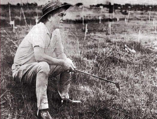
By 1949, Pres. Quirino had decided to reduce the size and move the Quezon Memorial Park from the intersection of EDSA and Quezon Avenue, to a 27 hectare lot at the intersection of North Avenue, East Avenue and Quezon Avenue. This change of the original plans caused tensions with Congressman Tomás Eduardo Bernabéu Morató (1887-1965), who was part of the original team that helped Pres. Quezón select the site for the new capital. Despite that, in 1951 Quirino held a national design competition for a monument to Pres. Quezón; with a presidential library, a museum, and a theater in the park. Arch. Federico S. Ilustre (1912–1989) was able to win the contest, and supervised the construction that started in 1952. The Italian sculptor, Francesco Riccardo Clementi Monti (1888-1958), was commissioned to create the three “muses” of Luzon, Visayas and Mindanao atop the memorial.

After the 1949 assassination of Mayor Ponciano A. Bernardo (1905-1949), Pres. Quirino appoints Assistant Executive Secretary Nicanor A. Roxas as acting Quezon City mayor. On the 22nd of October that same year, Pres. Quirino and Mayor Roxas break ground at the “Constitution Hill” for the new national capitol building, 8.5 kilometers from the original site proposed by Pres. Quezon. This starts the construction of government buildings outside the Diliman Quadrangle area, starting with the 1950 transfer of the Armed Forces of the Philippines’ Colonel Victoriano Luna General Hospital from Mandaluyong to the Teacher’s Village’s Matiisin Street (now V. Luna Avenue). On the 4th of January 1950, Ignacio Santos Diaz is appointed as mayor of Quezon City and continues in the development of the Diliman Quadrangle.

By late 1950, Pres. Quirino changes the plans for the Diliman Quadrangle, and holds a competition to design a Veterans Medical Center, in coordination with the US and Philippine Armed Forces, to be constructed in the site for the capitol. The winner design was created by Arch. Pablo Dayrit Panlilio (1912-2012), and the construction was oversaw and completed in 1955, by the Bureau of Public Works. The Bureau of Public Works was headed by Arch. Federico Ilustre, the designer of the Quezon Memorial. Arch. Ilustre would design more government buildings in the Diliman Quadrangle from the term of Pres. Magsaysay to Pres. Marcos. At the Elliptical Road surrounding the Quezon Memorial site, Ilustre saw the construction of the national government’s Department of Agriculture and Natural Resources (DANR) compound (1957), the DANR’s Bureau of Fisheries compound in 1957 (now the abandoned GSIS, Government Service Insurance System, compound), the Department of Agriculture Extension offices (1958), the People’s Homesite and Housing Corporation compound (1957), and the Philippine Coconut Administration (1958). Another addition to the Elliptical Road is the DENR’s Philippine Parks & Wildlife Center (1954) at the corner of the Elliptical Road and North Avenue. Outside the Elliptical Road, Ilustre designs the Department of Social Welfare compound (1968) at the end of Constitution Road, and the Department of Agriculture’s National Irrigation Administration Office (1968) along the NIA Road.

By the administration of Pres. Marcos many of the government departments on the Elliptical Road get overhauled and renamed. The Department of Agriculture and Natural Resources becomes the Ministry of Agriculture and Food by 1974 (now just the Department of Agriculture). The Philippine Coconut Administration is renamed as Philippine Coconut Authority in 1976, with a new building constructed in 1981. The Department of Agriculture Extension offices remain the home for several bureaus under the department, until its reorganization as the Agricultural Training Institute in 1987. The People’s Homesite and Housing Corporation is renamed as the National Housing Authority in 1975. Additions to the Elliptical road are the Department of Agrarian Reform compound (1971), the National Labor Center TUCP-PGEA compound (1974), the Department of Health’s National Kidney Foundation of the Philippines (1981) at the corner of East Avenue and the Lung Center of the Philippines (1982) on the corner of Don Mariano Marcos Avenue (now Quezon Avenue), the Department of Agriculture’s Bureau of Soils and Water Management (1990) and Research and Development Management and Information Center (2004) at the corner of Visayas Avenue.

In 1962, Mayor Amoranto breaks ground for the new Quezon City Hall, which has been transferred from the Bernardo Park to a lot between Kalayaan Avenue, East Avenue and the Elliptical Road. The new city hall was designed by Arch. Ruperto Cecilio Gaite (born 1925), with an adobe bas-relief of the history of Quezon City and the life of Pres. Quezón by Eugenio Bunuan; whom Gaite has collaborated in several other projects. The Quezon City Hall complex would be completed and inaugurated in 1974.

There are seven roads that “radiate” from the Elliptical Road; the major avenues of the Quezon Boulevard Extension (Quezon Avenue and Commonwealth Avenue), Visayas Avenue, and the East and North avenues, while the minor roads are Maharlika Street and Kalayaan Avenue. East Avenue was supposed to be the site for the proposed Supreme Court and Department of Justice, in which is now the location of the Hospital ng Bagong Lipunan (now the East Avenue Medical Center or GSIS General Hospital), which was completed in 1969. Other government institutions on East Avenue that were built during the Marcos administration are the Bangko Sentral ng Pilipinas’ Security Plant Complex (1974), the Department of Health’s Philippine Heart Center (1975) and the National Kidney Foundation of the Philippines, the Ministry of Transportation and Communications’ Land Transportation Office (1979), the Ministry of Justice’s National Land Titles and Deeds Administration (1980), the Department of Environment of Natural Resources’ Laguna Lake Development Authority (1969) and Environmental Management Bureau (1999), and the National Statistics Office compound (1987). One of the more significant buildings is the Philippine Social Security System Main Office, which was designed and completed in 1965 by the National Artist for Architecture, Juan Felipe Nakpil (1899-1986).

There are four minor roads that are perpendicular to East Avenue, which have significant government agencies located on these streets. Three of these roads link East Avenue with the Don Mariano Marcos Avenue, while the V. Luna Avenue connects the East Avenue traffic with the Homesite Projects 2 and 3, as well as the Teacher’s Village. The oldest government institution on V. Luna Avenue is the Colonel Victoriano Luna General Hospital, which was completed in 1950 as the AFP’s (Armed Forces of the Philippines) central hospital. This was followed by the 1974 construction of the Philippine Constabulary’s Metropolitan Command (MetroCom) Northern Police District Camp Datuin, which renamed as the Camp Brigadier General Tomas Bingo Karingal in 1990 after its slain commander of 20 years. Between 1976 and 1980, the National Security Council (NSC, est. 1950) compound was constructed at a lot close to the East Avenue intersection. The NSC is directly under the Office of the President of the Philippines, and houses the office of the National Security Adviser and the National Intelligence Coordinating Agency.

One of the perpendicular roads that connect East Avenue to Don Mariano Marcos Avenue is the NIA Road, which was named after the DANR’s National Irrigation Administration Office that was built on the street in 1963. Other government agencies constructed on the NIA Road are the Department of General Services’ National Printing Office (1972), the National Electrification Administration (1973) before it was placed under the Ministry of Energy in 1977, Ministry of Transportation and Communications’ Bureau of Posts office (1979), and the Philippine Drug Enforcement Agency (2002).

The second perpendicular road to East Avenue is BIR Road, which was named after Ministry of Finance’s Bureau of Internal Revenue National Office (BIR) that was constructed in 1976. However, before the BIR building was completed, the National Power Corporation (NAPOCOR) complex was erected in 1971. And in 1979, these were followed by Ministry of Transportation and Communications’ National Telecommunications Commission (NTC) and the Ministry of National Defense’s Philippine Atmospheric, Geophysical and Astronomical Services Administration (PAGASA) compound and planetarium.

The third perpendicular road to East Avenue is the Agham Road, which is actually an extension of the BIR Road. The street was named after the Filipino word for science, with the establishment of the Philippine Science High School (PSHS) campus in 1970 and the nearby PAGASA compound in 1974. The PSHS is a unique government school system, as it is governed by the National Science Development Board (now the Depart of Science and Technology) and the Department of Education. Other government institutions on Agham Road are the Philippine Children’s Medical Center (1979) and the National Power Corporation (NAPOCOR) compound’s National Transmission Corporation (2001) and National Grid Corporation of The Philippines (2009) at the corner of Don Mariano Marcos Avenue, the Office of the Ombudsman (1989) and the Department of Labor and Employment’s Occupational Safety and Health Center (1988) at the corner of North Avenue.

Commonwealth Avenue was part of the Quezon Boulevard Extension, but was later renamed the Don Mariano Marcos Avenue, after the Congressman Mariano Rubio Marcos (1897-1945), the father of Pres. Marcos. The oldest government institution on Commonwealth Avenue is the Philippine Social Science Council (PSSC), which was constructed in 1968. This was followed by the Asian Institute of Tourism (AIT) of the University of the Philippines in 1976, the Department of Energy’s Philippine Nuclear Research Institute (1963), the Commission on Audit compound in 1973, the Commission on Human Rights compound in 1987, and the Sandiganbayan in 1999.
The 2.6 kilometer Visayas Avenue is the home of many bureaus and sub-offices of the then-Department of Agriculture and Natural Resources (DANR). At the east side of the road, the Bureau of Agricultural Research (BAR) compound was constructed in 1987, at the corner of the Elliptical Road, with the Research and Development Management and Information Center (RDMIC) added in 2004. This is followed by the Bureau of Plant Industry compound that also opened in 1987, with the National Pesticide Analytical Laboratory, the Nationals Seed Quality Control Services, and the Bureau of Agricultural and Fisheries Product Standards (opened in 1998) inside. The next DANR complex is the Bureau of Animal Industry (BAI), which opened in 1978. Inside the BAI compound are the Philippine Animal Health Center / Animal Disease Diagnosis and Reference Laboratory (opened 1992), the Viral Vaccine Production Laboratory, the National Dairy Authority (founded 1995), the Philippine Fiber Industry Development Authority (established 2013), the Livestock Development Division, and the Fertilizer and Pesticide Authority (established 1973). The last DANR complex is the National Food Authority Warehouse (NFA) compound (established 1972), with the National Meat Inspection Services (established 1972). All the roads in the DA compounds and the nearby communities are named after things related to the DANR; such as Honeybee, Swine and Duck streets in the Bureau of Animal Industry compound, and lands, Forestry, Mines, Soil, and Fisheries streets of Barangay Vasra; which was then a residential area for government officials.

At the west side of Visayas Avenue, Department of Agriculture’s Bureau of Soils and Water Management (BSWM) was moved to the corner of the Elliptical Road in 1990. This is followed by the Department of Environment and Natural Resources (DENR) complex, with the Forest Management Bureau that was established in 1987. The only government institution on Visayas Avenue that is not connected with old Department of Agriculture and Natural Resources is the Government Television (GTV-4) compound, which was established in 1974. Currently it is now the Philippine Information Agency (PIA) compound, which was established 1986, which houses the offices and studios of the government’s People’s Television Network.

The next major road is the North Avenue, with the Department of Agriculture (DA) occupying the northern corner of the Elliptical Road, and the Ninoy Aquino Parks & Wildlife Center at the southern corner. Through an access road at the north side of North Avenue are Department of Environment and Natural Resources’ Bureau of Mines and Geosciences compound (1978), with the Department of Transportation and Communication’s Office of Transportation Cooperative and the Department of the Interior and Local Government’s DILG National Capitol Region Office taking up the rest of the compound. Another access road leads to the DA’s National Food Authority office, the Philippine Sugar Commission, the Sugar Regulatory Administration, and the Philippine National Volunteer Service Coordinating Agency (PNVSCA). The last government institution on the north side of North Avenue is the Veterans Memorial Medical Center, while across it is the Department of Labor and Employment’s Occupational Safety and Health Center at the corner of Agham Road. The rest of the establishments on North Avenue are the commercial malls of SM City North and Trinoma.

The last major road that radiates from the Elliptical Road is the Quezon Avenue, which was built as the Quezon Boulevard Extension in 1939 to link the proposed Philippine Military Academy in Novaliches (now the Batasan Pambansa complex), the University of the Philippines in Dilimán, the government offices of the Diliman Quadrangle, and the City of Manila. The road was later renamed as the Don Mariano Marcos Avenue in the 1960s, the divided as the Quezon Avenue and Commonwealth Avenue in the 1980s. At the corner of the Elliptical Road and Quezon Avenue are the Ninoy Aquino Parks & Wildlife Center at the northwest corner and the Lung Center of the Philippines is located at the southeast corner. The government institutions on the northwestern side of Quezon Avenue are the Philippine Children’s Medical Center (PCMC) at the corner of Agham Road, the lot of the Department of Agriculture and Natural Resources’ Manila Seedling Bank (1977-2014) at corner of EDSA, and the Welcome Rotunda at the end of the 7.1-kilometer road. At the southeaster side of Quezon Avenue are the Department of Health’s Philippine Blood Disease and Transfusion Center, the Department of Science and Technology’s PAGASA compound and the Department of Energy’s National Power Corporation (NAPOCOR) compound at the corner of Agham Road, and the Bantayog ng mga Bayani (1992) memorial to victims of Martial Law. The rest of the properties southeast of the intersection of Quezon Avenue and EDSA and commercial establishments.

Although the Quezon Memorial and the four quadrangle avenues were completed by 1940, the proposed Quezon Park’s southwestern areas were turned into residential areas by the 1950s. The “West Triangle” area is located between West Avenue, Quezon Avenue and EDSA, and was first developed by the establishment of the Philamlife Homes in 1955, for employees of the Philippine-American Life Insurance Company (Philam). This was followed by the Homesite Project 7 relocation site for employees of the various media outlets, which would become Barangay West Triangle in 1976. The first school in the area was the Jose Abad Santos Memorial School (JASMS, 1956) of Conrado Francia Benitez (1889-1971) and Francisca Tirona-Benitez (1886-1974).

The South Triangle is located between Timog Avenue (formerly South Avenue), Quezon Avenue, and EDSA, and was formerly a residential area that was part of the Homesite Project 1. Now it is a mixed used area, with both business and entertainment establishments amidst the residences. The most noted businesses in the area are the media giants of ABS-CBN and GMA.

Since Pres. Quezón conceived of the Diliman Quadrangle as the capitol site of the Philippines, there were many factors that prevented the realization of his dream. However, through the attempts of many individuals, and the work of thousands of laborers, the vision of Quezón would never die. And in the 1970s, this was somewhat realized with the completion of the Quezon City Hall and Quezon Memorial Park.


15 thoughts on “Completing Quezon’s Dream: A Brief History of the Diliman Quadrangle and the Government Landmarks within”